|
Maps
• Historical Maps
• Republic of Armenia, 1918-1920
• Sovietization of Caucasus and Redrawing of the Borders
• The Renewal of the Conflict, 1988-1994
| • Historical Maps |
Bildtext
|
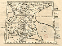
1535
Description: Asiae Tabula III: Colchis, Iberia, Albania, Armenia major / [Ptolémée]
Date: 1535
Source: Bibliothèque nationale de France
Author: Ptolémée, Claude (100?-170?). Auteur adapté
Servet, Michel (1511-1553). Éditeur scientifique
|
Bildtext
|
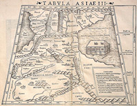
1552
Tabula Asiae III
Description: Excellent example of Munster's Ptolemaic map of the region between the Black Sea and Caspian Sea extending south to include all of Armenia Maior and part of Armenia Minoris. Shows Noahs Arc in the Caspian Sea, believed to have come to rest in a mountain in Armenia according to the map. Shows Armenia Maior, Iberia, Albania, Colchis, Porte Albanie, the Euphratis River, the Tigris, Assyriae, and many other place names in the cradle of civilization.
Map Maker: Sebastien Münster
|
Bildtext
|
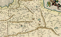
1579
Description: Tabula Asiae III [Armenia, Georgia, Turkey, etc.]
Date: 1579
Source: www.raremaps.com
Author: Gerardus Mercator (1512–1594)
|
Bildtext
|
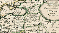
1654
Alexander the Great's Expedition to Europe, Asia and Africa.
Source: Pierre Du Val Expeditionis Alexandri Magni Per Europam, Asiam et Africam.
|
Bildtext
|
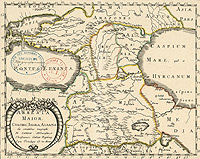
1655
Description: Armenia maior, Colchis, Iberia, Albania / ex conatibus geograph. N. Sanson ; L'huillier sculp.
Date: 1655
Source: Bibliothèque nationale de France
Author Jan L'Huilier (17th century) - Engraver: Nicolas Sanson (1600–1667) |
Bildtext
|
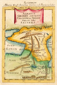
1719
Albania, Armenia Major, Colchis and Iberia in Ancient times
Source: Albania Groß Armenia Colchis und Iberia nach der Alten Gericht
Cartographer: Mallet, Allain Manesson
Frankfurt,
Date: 1719 |
Bildtext
|
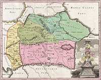
1720
Armenia Vtraque.
Weigel Map of the Caucuses including Armenia, Georgia, and Azerbaijan
An uncommon 1720 map of the Caucuses by Christopher Weigel. This most unusual aspect of this map is its focus on the lands between the Black Sea and the Caspian, commonly known as the Caucuses. In antiquity most of this region was part of the Armenian Empire or Greater Armenia, a vast area of land stretching from Cappadocia and the Mediterranean to the Caspian and as far south as Persia. Later the Empire of Armenia was incorporated into the Roman Empire, the Byzantine Empire, and Persia. Today this region is divided between western Turkey, Georgia, Armenia and Azerbaijan. This map depicts Armenia at its greatest extant during the Roman Period. A title cartouche in the lower right quadrant includes 9 Roman coins on a decorative column. Published by Christopher Weigel for the 1720 issue of the Senca Historiarum Orientalis .
Source: Weigel, C., Senca Historiarum Orientalis Quinti Seculi P.N. Chr., 1720.
|
Bildtext
|
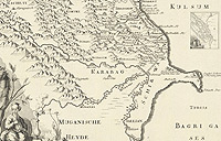
1727
Caspian Sea between the western shore of the rivers Kur and the Volga, and adjoining provinces
Original Title: Maris Caspii Littori occidentali inter Fluviorum Wolgae et Kur Ostia
Author: L'Isle, Joseph Nicolas de; Akademiia nauk SSSR; Academie der Wissenschafften; Academy of Sciences, St. Petersburg
Publisher: Kayserl. Academie der Wissenschafften
St. Petersburg
Collection: David Rumsey Historical Map Collection
Publication Date: 1745
|
Bildtext
|
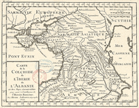
1729
Description: Map of Colchis, Iberia, Albania and surrounding countries according to Roman history
Original Title: Carte de la Colchide, de l'Ibérie, de l'Albanie et des pays circonvoisins pour servir à l'intelligence de l'histoire romaine / par Henri Liébaux ; F. Baillieul sculp.
Date: 1729
Source: Bibliothèque nationale de France
Author: Liébaux, Henri (16..-17..? ; cartographer). cartographer; Baillieul, François (169.-1748). Engraver
|
Bildtext
|
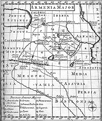
1736
This is a map of Armenia in the early medieval period. The map accompanies
the printed text of the Latin and Armenian edition of Movses Khorenatzi's "History
of Armenia", which also incorporates the geographical text called "Ashkharhatzuytz"
(World Mirror) attributed here to Movses Khorenaci, but lately attributed to
the seventh-century polymath, Anania Shirakatzi. the Latin translation is by
William and George Whiston and the book was published in 1736, in London.
The map has been drawn taking into consideration the descriptions of "Ashkharhatzuytz".
It shows the 15 provinces of Greater Armenia and their approximate borders.
Lesser Armeni is in Eastern Anatolia, just to the west of Greater Armenia. The
external borders of Greater Armenia are shown by broken lines, while the borders
of the provinces are indicated by dotted lines. The towns shown include "Erivanum" (Yerevan), "Valarsapata"
(Vagharshapat or Echmiadzin), "Arzerum" or "Carin" (the
old armenian name of Erzerum - Karin; in Greek Theodosiopolis), "Vannum"
or "Semiramocerta" (Van or Shamiramakert), "Betlis" (Bitlis),
"Arsamosata" (Arshamashat) and "Naxuanum" (Nakhijevan).
"Mount Ararat" or "Masis" is also shown. The Armenian name
of the River Arax(es) - "Erasches" (Yeraskh) is also mentioned. Comparing
this map with the Ptolemaic version of the same area, it can be noted that the
earlier Ptolemaic maps had an acceptable degree of accuracy.
Private collection - London
|
Bildtext
|
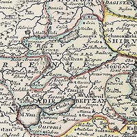
1750
A detailed map of Persia and its adjoining countries with Armenia.
Original Title: Nieuwe kaart van 't Ryk van Persie.
Amsterdam, 1750 |
Bildtext
|
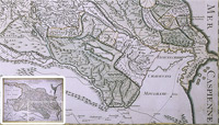
1766
General map of Georgia and Armenia. Drawn in St. Petersburg in 1738 from the maps, memories, observations and measurements of the locals; translated from Georgian into French by the secretary of the king of Georgia, published in 1766 by M . Joseph Nicolas Del'Isle.
Original Title: Carte générale de la Georgie et de l'Arménie
Bibliotheque nationale de France
|
Bildtext
|
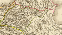
1822
Map of Asia Minor, Armenia, Syria, Mesopotamia and Caucasus
Original Title: Carte generale de l'Asie-Mineure, de l'Armenie, de la Syrie, de la Mesopotamie, du Caucase &a. par A.H. Brue, Geographe de S.A.R. Monsieur. A Paris, Chez l'Auteur, rue des Macons-Sorbonne, no. 9, et chez les principaux marchands de geographie. Mars 1822.
Date: 1822
Source: David Rumsey Collection
Author: Adrien-Hubert Brué (1786–1832)
|
Bildtext
|
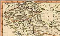
1835
Persis, Parthia, Armenia, etc. Fenner Sc., Paternoster Row. (London, Joseph Thomas, 1835)
Date: 1835
Source: David Rumsey Collection
Author: Rest Fenner
|
Bildtext
|
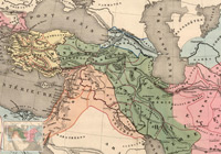
1838
Ancient Empire of Alexander. Simplified Elementary Atlas.
Original Title: Anciens Empires Jusqua Alexandre. Atlas Elementaire Simplifie. Publie par J. Andriveau-Goujon. E. Soulier del. A Paris, chez Andriveau-Goujon, Editeur, Rue du Bac, No. 17. Revu par Mr. Hase, Membre de l'Institut.
Date: 1838
Source: David Rumsey Collection (www.davidrumsey.com)
Author: Soulier, E.; Andriveau-Goujon, J.
|
Bildtext
|
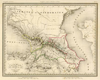
1842
Map of Caucasus
|
Bildtext
|
1844
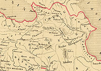
Map of the Persian empire
Original Title: Carte de l'Empire des Perses. Pour servir a l'intelligence des livres d'Esdras, de Nehemias, de Tobie, de Judith, d'Esther, de Job et des Prophetes. Depuis 588 jusqu'a 536 avant J.C. epoque ou finit la captivite. Dressee sous la direction de A. Houze. (In upper margin:) Atlas histque. (et) geogque. de la Terre Sainte. Carte VIII. (Paris, Chez P. Dumenil, editeur, rue des Beaux-Arts, 10. 1844)
Date: 1844
Source: David Rumsey Collection (www.davidrumsey.com)
Author: Antoine Philippe Houze
|
Bildtext
|
1865
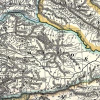
Albania, Iberia, Colchis, Armenia, Mesopotamia, Babylonia, Assyria.
Author: Spruner, Karl von, Spruner-Menke Atlas Antiquus,, (Gotha: Justus Perthes), 1865.
Source: David Rumsey Collection |
Bildtext
|
1865
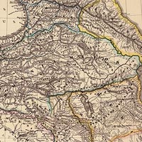
Albania, Iberia, Colchis, Armenia, Mesopotamia, Babylonia, Assyria.
Karl von Spruner, Spruner-Menke Atlas Antiquus, (Gotha: Justus Perthes). |
Bildtext
|
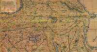
1872
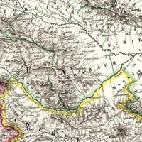
The Asian Turkey map (Asiatische Türkei) 1872. Map showing the borders of Iranian Azerbaijan (Aderbeidjan), the Shirvan province, as well as Armenia and Karabakh.
Author: Johann Samuel Heinrich Kiepert, Neuer Handatlas |
Bildtext
|
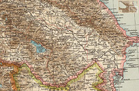
1893
Middle East during the last period of the Ottoman Empire, 1893
Original Title: Naher Osten zu Zeit des osmanischen Reiches im jahr 1893.
Author: Unknown
|
Bildtext
|
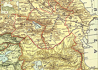
1895
The Caucasus
Collection: David Rumsey Historical Map Collection
Attributed Author: Andree, Richard; Times (London, England)
Date: 1895
Publisher: The Times, London
Full Title: The Caucasus. (Published at the office of "The Times," London, 1895)
Engraver or Printer: Cassell & Company
Publication Author: Andree, Richard; Times (London, England)
Pub Date: 1895
|
Bildtext
|
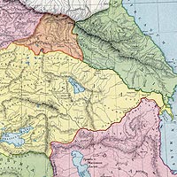
1901
Asia Minor, the Caucasus & the Black Sea. London atlas series. Stanford's Geogl. Estabt. London: Edward Stanford, 26 & 27, Cockspur St., Charing Cross, S.W. (1901)
Date: 1901
Source: David Rumsey Collection (www.davidrumsey.com)
Author: Edward Stanford (1827–1904)
|
Bildtext
|
1907
Ancient Map of Armenia, Colchis, Iberia, Albania, showing that the border between Albanian and Armenia follows the Kur River.
PD The Atlas of Ancient and Classical Geography by Samuel Butler, Ernest Rhys, ed. (1907, 1908) |
| |
| • Republic of Armenia, 1918-1920 |

Bildtext
|
1918-1920
Republic of Armenia, 1918-1920 and the Disputed areas in Caucasus.
Source: Armenica.org |

Bildtext
|
1918-1921
Territorial losses through different treaties, 1918-1921 |
| |
| • Sovietization of Caucasus and Redrawing of the Borders |
Bildtext
|
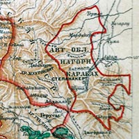
1926
Map of Armenian SSR, 1926, before the borders of southern Armenia, Karabakh and Nakhichevan were redrawn.
Source: Soviet Encyclopedia, 1926, Vol. 3, p. 417. |
Bildtext
|
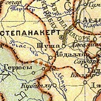
1928
Transcaucasian Socialist Federative Soviet Republic,
Atlas of the USSR
|
Bildtext
|
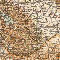
1929
Map of Caucasus and Caspian Sea Region. The map shows Armenia, Karabakh and Nakhichevan before the borders were redrawn during Stalin's time. Note the border connection between Armenia and Karabakh as well as the lack of common borders between Turkey and Nakhichevan before the changes were made during Stalin's time.
Source: David Rumsey Historical Map Collection: Caucasia e Mar Caspio,Kavkaz i Kaspiiskoe More. Propr. Artistico-letteraria del T.C.I. Ufficio cartografico del T.C.I., List Nr: 1012.038, p. 73-74; Serienr.: 78, (1929) |

Bildtext
|
Soviet Armenia
Map showing Armenian SSR, Karabakh and Nakhichevan after the borders were redrawn during Stalin's rule.
Source: Armenica.org
|
| |
| • The Renewal of the Conflict, 1988-1994 |
The territorial control during the development of the conflict, 1988-1993, before the ceasefire treaty came to power in 1994
Source: Armenica.org. Revision of the original map in AIM (Armenian International Magazine). |

Bildtext
|

Bildtext
|

Bildtext
|

Bildtext
|

Bildtext
|

Bildtext
|
| |
|

Bildtext
|
1992
Map of the Khojaly events and near Aghdam, 25-27 February 1992.
Source: The Office of the Nagorno Karabakh Republic, Washington DC. www.nkrusa.org |
| |
|
|
Detalined map of Nagorno-Karbakh showing the the territories controlled by both sides of the conflict as well as the line of contact.
See the map in whole. |
|
More maps at

|
|
